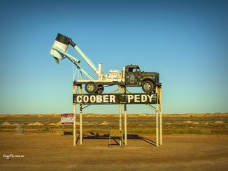
The Stuart Highway is one of Australia’s major highways. It runs from Darwin in the north, via Tennant Creek and Alice Springs, to Port Augusta, South Australia, in the south – a distance of 2,834 km. Its northern and southern extremities are segments of Australia’s Highway 1. The principal north-south route through the central interior of mainland Australia, the highway is often referred to simply as “The Track”.
The highway is named after Scottish explorer John McDouall Stuart, who was the first European to cross Australia from south to north. The highway approximates the route Stuart took.
The Royal Flying Doctor Service uses the highway as an emergency landing strip and sections of the highway are signed to that effect. These sections of highway have been specially selected and prepared for the landing of aircraft which only takes place after the piece of road has been closed by the police.
There are petrol and other facilities (meals, toilets, etc.) available at reasonable intervals, usually around 200 km but some are a lot longer. Some rest stops are located at scenic points with information boards, but most are little more than a picnic table and a rubbish bin in an otherwise deserted area.
It is a great road trip, perhaps Australia’s Route 66. You will find more pictures here;
© New “Old Houses” Gallery here
© New “Landscapes and Seascapes” Gallery is available here.


Be the first to comment